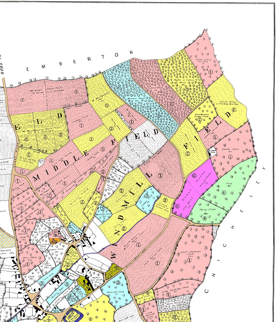
This map shows how the north east part of Sherington might have looked c.1580. It is not an actual old map, but a reconstruction by Professor Chibnall originally published as Map 3 in his book "Sherington: Fiefs and Fields of a Buckinghamshire Village".

The distribution of land is given in the following tables: Open Fields - Demesne. This information is taken from Tables 49/50/51 and 47/48 of Chibnall's book, respectively. Note that there are a number of detailed discrepancies between the information on the map and that given in the tables.
Other maps:
Complete map of Sherington in 1580.
Larger scale maps of the other quadrants: North west, South west, South east.
In 1580, farming followed a 3-year cycle. The arable land was therefore divided into three fields: Marehill Field, Middle Field and Windmill Field. The division is shown on the Field map
Other dates: North east in 1300 - North east in 1796.