|
|
Water Lane |
 |
Water Lane is one of the original roads of the village. It goes from the junction of the High Street and The Knoll, continuing to the Ouse at the bottom of the village, with a fair number of older properties along it. |
The picture above shows the slaughter house that was owned by the shop that is now known as Virginia House Stores when it was a general butchers and grocers. At the time, there was little or no refrigeration as we know it today and the animals reared by the local farmers were sold at the local market and then slaughtered and sold by the butcher. At that time Sherington had three butchers. Water Lane has constantly evolved throughout the history of Sherington, from Water Lane Farm House to The Rick Yard development, with the constant demands on housing people within the village. Water Lane has seen many of these changes. | |
As we start to walk down Water Lane we come across what has become known as the Old Quakers House. This house was originally thought to have been the Quaker's Meeting House, but after some research this has been found to be not true, as their Meeting House was further down the lane at No. 40 Water Lane (see below). Whether it was built for the preacher or for members of the congregation, or the owner just liked the arched windows style, we can at present only guess. What we can say is that the building is now a semi-detached property housing two separate families. |
 |
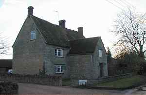 |
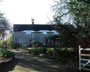
Water Lane Farm is one of the old farms of the village. At the time of the enclosure act of 1796, it was owned by local farmer Thomas Battains. Today it houses one of the longer staying village families, who have lived in the house for at least 4 generations. |
|
Both Water Lane Farmhouse and its stone barn are Grade 2 Listed Buildings. | 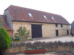 |
In the farm yard of Water Lane Farm, the housing development known as "The Rickyard" has been built. In the original yard, there were two buildings. One was a prefabricated house, owned by the farm and the owner's mother-in-law lived in it. This was removed for the new development. The other was a barn that was converted in to a house at the same time as The Rickyard development.  | |
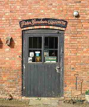
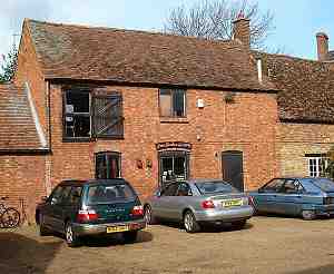 Peter Gardner Gunsmith and the Sherington Shooting Centre are also located at Water Lane Farm. |
 |
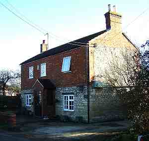
No. 23 Water Lane As we walk further down the lane we come across number 23. This House has a very interesting roof line as the upstairs windows seem to come higher than the lower roof line and this gives it an undulating roof line. This is usually a sign that the roof was at one time thatched, but if you know any different then please let us know. |
 |
 | 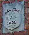 No. 25 Water Lane This is Oak Villa and has a plaque dated 1898. |
No. 40 Water Lane - Site of the Friends Meeting House (Quakers) Further down Water Lane, we find No. 38 and 40 together. On the Enclosure Map of 1796 the plot of land where these properties now stand was owned by the Quaker Society and the plot was registered as a "Meeting House". The current dwelling was built by Edward Latchmore as three identical farm workers cottages for letting with gardens to the front. There is evidence that some of the materials that were used were not new and very possibly they were taken from an earlier building. Edward Latchmore owned the property from 1829 to 1841. | 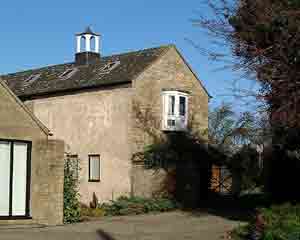 |
In 1973 a statutory demolition order was served on the property and the current owner of No. 40 purchased the property and renovated it to its current state. | |
 | As we walk further down we come to one of the few remaining industrial parts of the village. This is known as Smith's Yard, as it is located on the land that is owned by the Smith family. It currently holds a wide section of light industrial businesses from car repairs to furniture restorers. |
We are nearly out of the village now but in the distance we can see End Farm. From End Farm there is a bridle path that will take you to Tyringham, past Fences Farm. Next to the path just past the farm in the field to your left, there is a private foot and tractor bridge over the Ouse linking two areas of farm land between Sherington and Lathbury. If you walk any further past End Farm, you will find yourself next to the village sewage works. |  |
At this point we need to turn around and head back to the High Street. | |
Flooding
As its name implies, Water Lane is prone to occasional flooding. It runs alongside a stream which tends to overflow after particularly heavy rain. Click on the archive photos to view full size.


