Note: This section of the website is a 'work in progress'. Further information will be added in due course
- check back for updates and additions
- check back for updates and additions
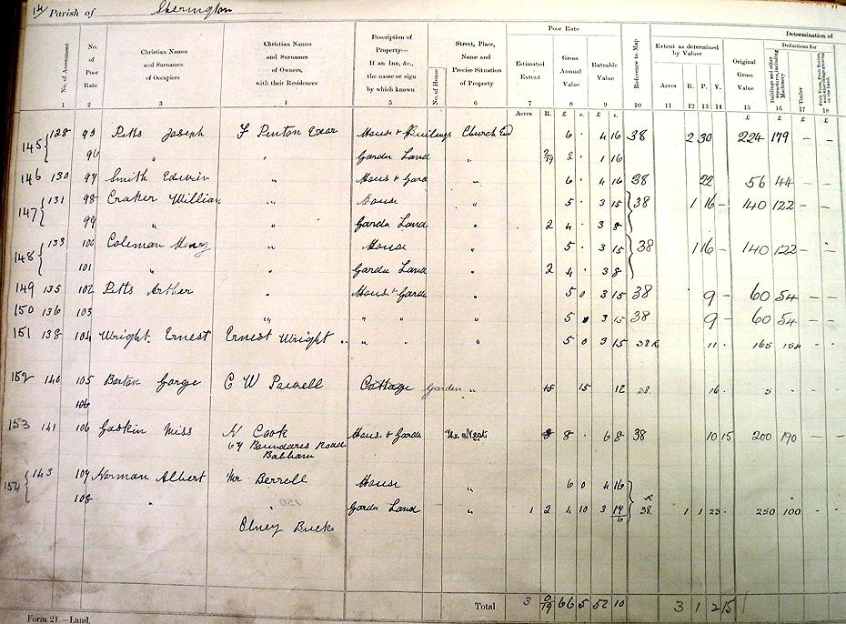
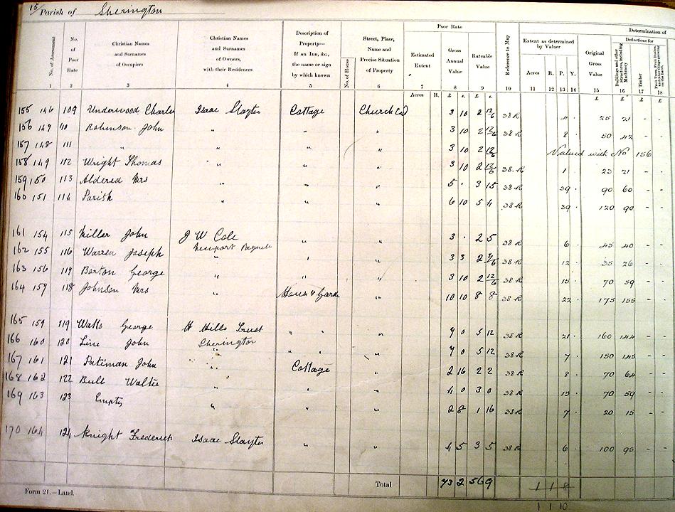
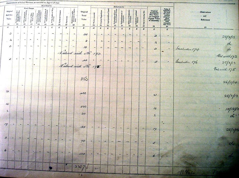
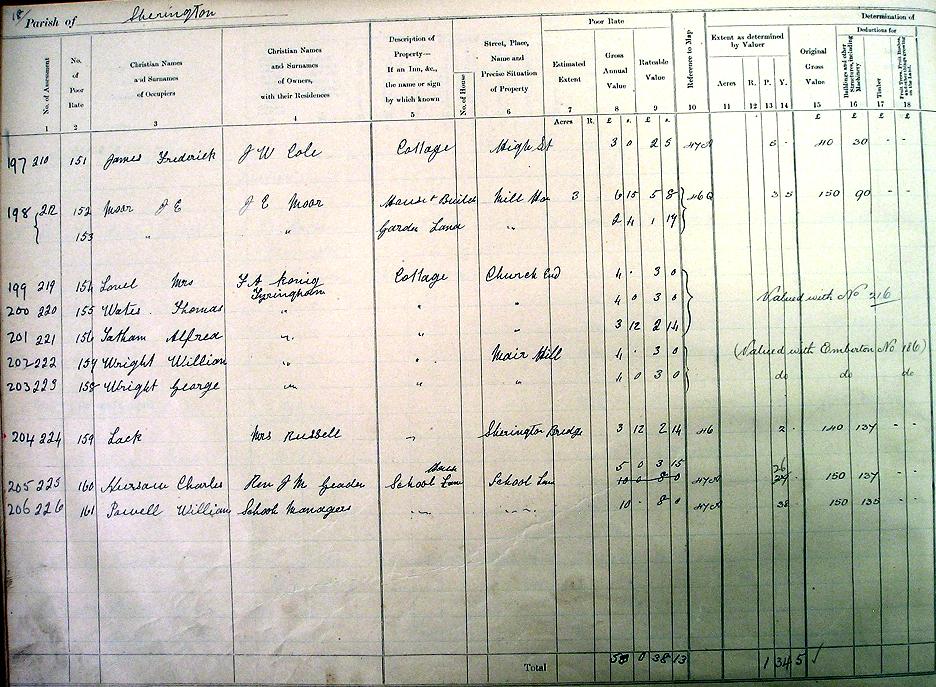
The Finance (1909-1910) Act, 1910, introduced a new tax on land values and therefore to implement it a detailed survey of all land was carried out over the following few years. All plots of land were identified and numbered, and both the occupiers and the owners were recorded, together with the valuation assessment. The Ordnance Survey maps that were current at the time (the 1900 1:2500 series) were marked up with the number of each plot of land and color shaded to distinguish each plot and corresponding buildings. The names and valuation details, plus cross-references to the maps, were registered in Field Books.
There are two sets of records:
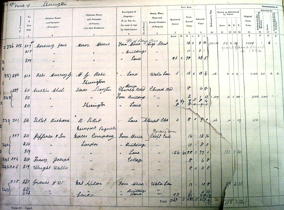
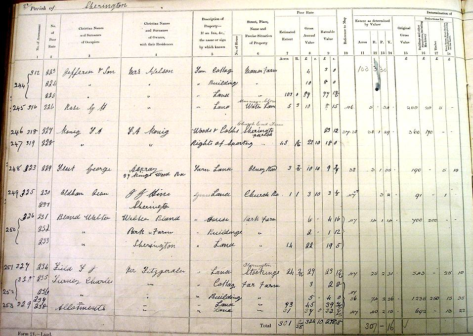
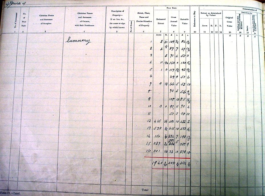
- The first set consists of the maps and Valuation Books (also called the 'Domesday' Books) used to carry out the Survey itself, and the ones for Sherington are held at the Centre for Buckinghamshire Studies in Aylesbury.
- The second set of maps and Field Books are the formal records of the Survey for the Inland Revenue, and these are now held at the National Archives at Kew.
For the purposes of this survey, Sherington was included with Chicheley in a single area. The survey was carried out by David Feasey of Sherington. The first data is dated 28 March 1913, but it then took several months to complete the details for all entries.
There are 270 entries. They follow the same order as used for the Poor Rate, but the numbering is different. Numbers 1 to 60 and 255 to 262 relate to land in Chicheley, the rest being in Sherington. Most of the parish is covered by four Ordnance Survey sheets - the corner where these sheets join being just north of The Knoll. They extend from the west to the east parish boundaries, and from the Emberton boundary down to beyond Sherington Bridge. The extreme south of the parish, i.e. Far End Farm, is on a separate sheet.
The Census is well-known as a record of individuals, but the absence of house numbers in the village at the time has meant that it has not been possible to pinpoint where each family actually lived, except for a few in named buildings, as most addresses were simply recorded as 'High Street' or 'Church End'. The 1910 Land Valuation Survey is therefore particularly interesting because it provides that missing link.
It is recommended that the information from the Domesday Books, the Field Books and the Survey Maps are all used in conjunction with the 1911 Census, to provide the fullest picture of Sherington just before the First World War.
Maps with Corresponding Lists of Occupiers and Owners
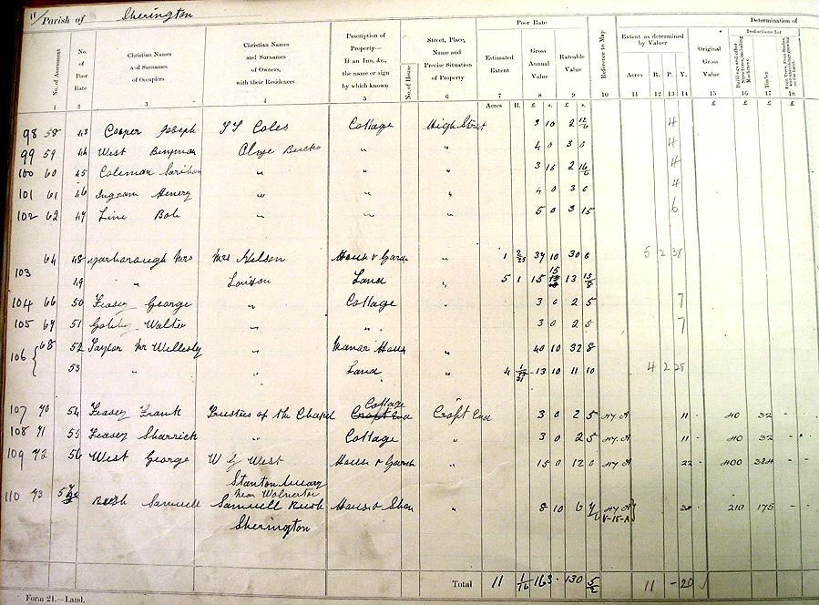
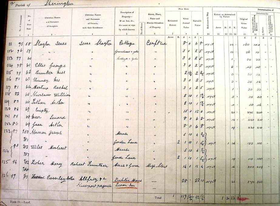
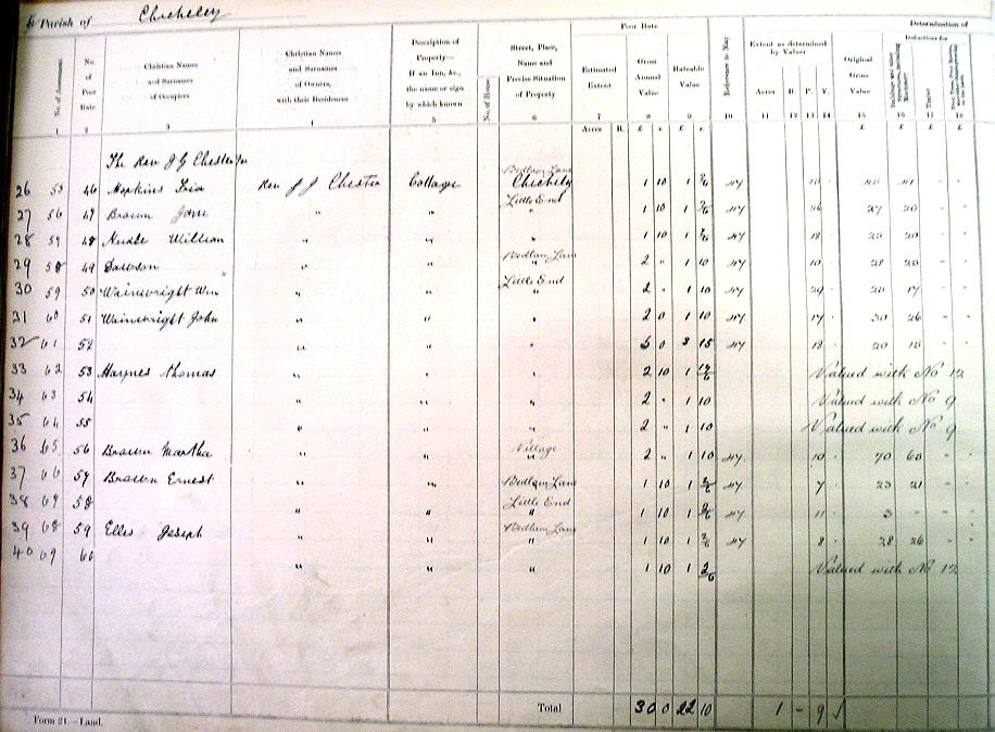
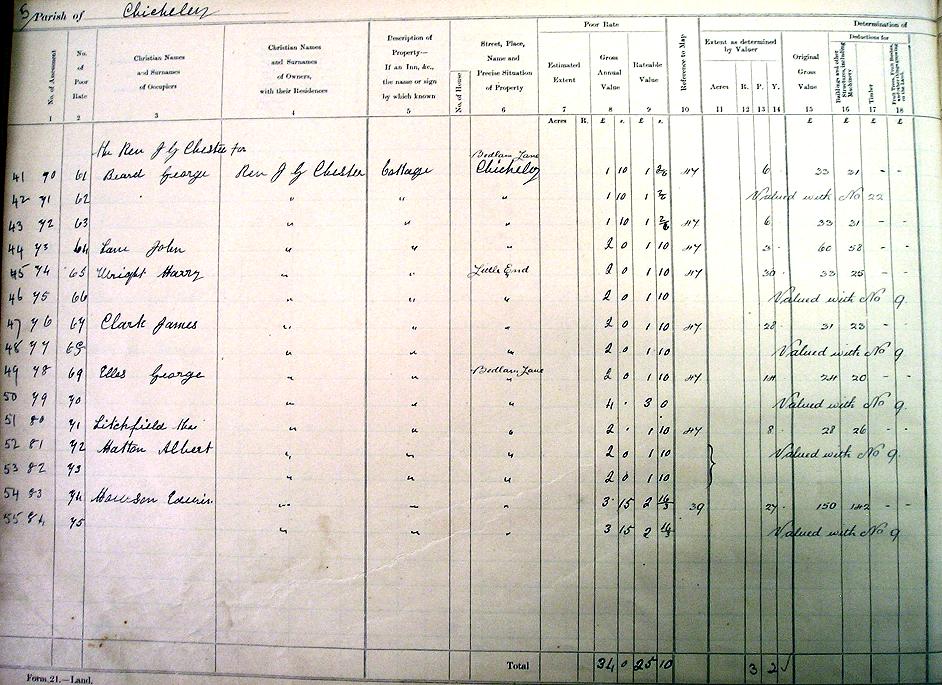
'Domesday' Valuation Book - Transcription
- Original numerical order - names/addresses of occupiers/owners plus map references (5 columns - Sherington entries)
- Alphabetical order of occupiers' surnames - names/addresses of occupiers/owners plus map references (5 columns - Sherington entries)
- Complete transcription - all 40 columns and including Chicheley entries (Microsoft Excel 2003 workbook)
Note: There are some obvious spelling mistakes in the original (e.g. Corft End for Croft End, Olnye for Olney, Sariah for Sarah and Henery for Henry). These have been changed in the first two lists, but the Excel spreadsheet tries to be faithful to the original.
'Domesday' Valuation Book - Photos Of Original Pages
Note: each entry is a double page spread - but the left and right hand pages have been photographed separately, because of their size.Introduction Page 1 Introduction Page 2
Sherington Page 1a - 61 to 72 Sherington Page 1b
Sherington Page 2a - 73 to 86 Sherington Page 2b
Sherington Page 3a - 87 to 97 Sherington Page 3b
Sherington Page 4a - 98 to 110 Sherington Page 4b
Sherington Page 5a - 111 to 126 Sherington Page 5b
Sherington Page 6a - 127 to 144 Sherington Page 6b
Sherington Page 7a - 145 to 154 Sherington Page 7b
Sherington Page 8a - 155 to 170 Sherington Page 8b
Sherington Page 9a - 171 to 183 Sherington Page 9b
Sherington Page 10a - 184 to 196 Sherington Page 10b
Sherington Page 11a - 197 to 206 Sherington Page 01b
Sherington Page 12a - 207 to 215 Sherington Page 12b
Sherington Page 13a - 216 to 226 Sherington Page 13b
Sherington Page 14a - 227 to 235 Sherington Page 14b
Sherington Page 15a - 236 to 243 Sherington Page 15b
Sherington Page 16a - 244 to 253 Sherington Page 16b
Sherington Page 17a - Summary
Sherington Page 18a - 254 to 268 Sherington Page 18b
Sherington Page 19a - 269 to 270 Sherington Page 19b
Chicheley Page 1a - 1 to 8 Chicheley Page 1b
Chicheley Page 2a - 9 to 15 Chicheley Page 2b
Chicheley Page 3a - 16 to 25 Chicheley Page 3b
Chicheley Page 4a - 26 to 40 Chicheley Page 4b
Chicheley Page 5a - 41 to 55 Chicheley Page 5b
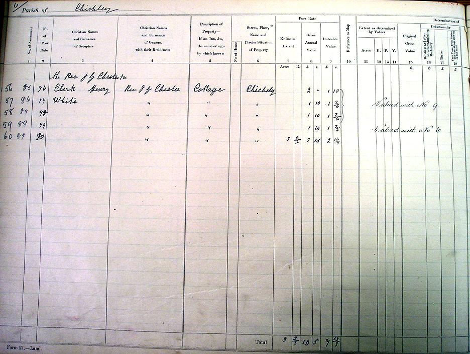
Chicheley Page 6a - 56 to 60 Chicheley Page 6b
Chicheley Page 7a - Summary
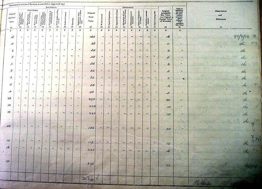
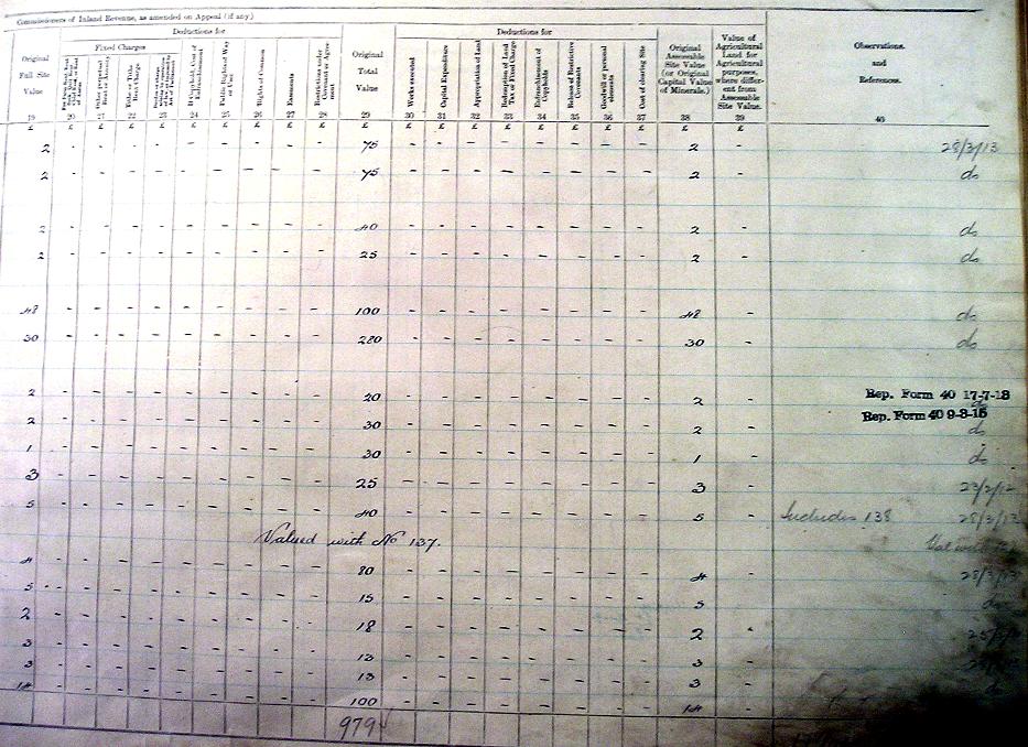
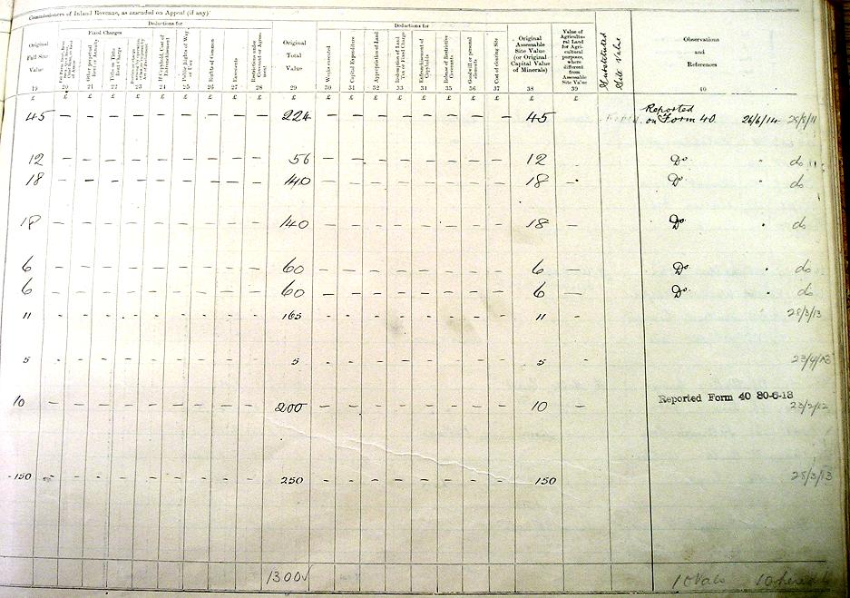
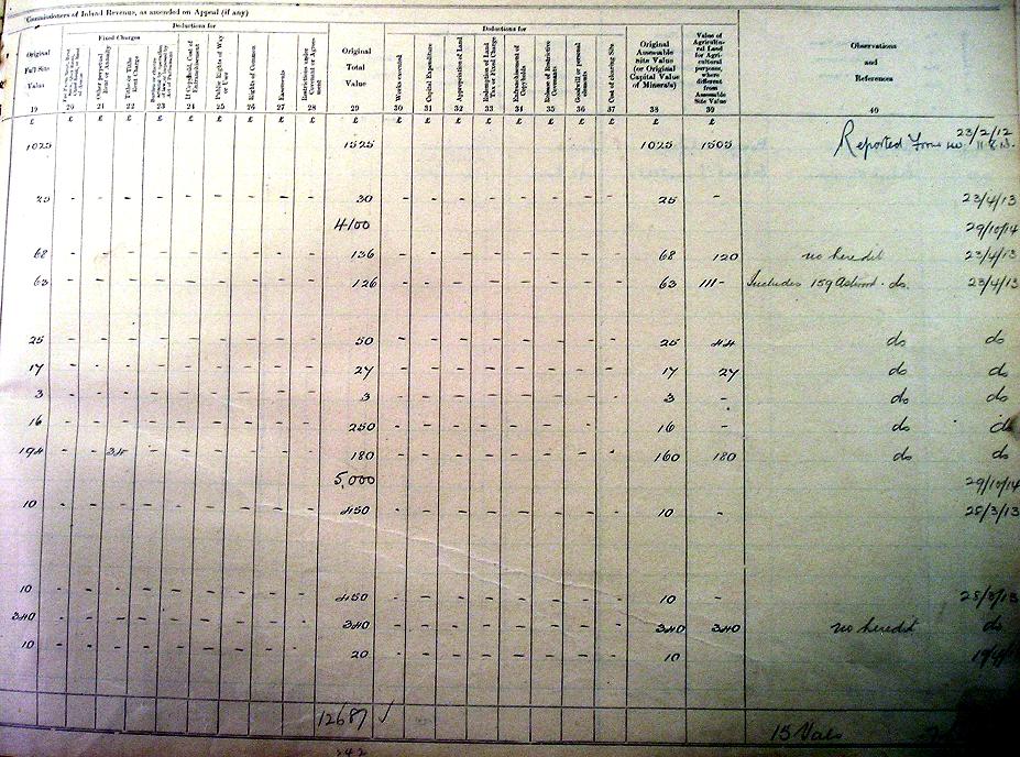
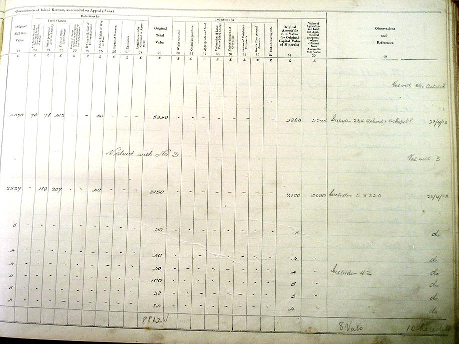
Field Books
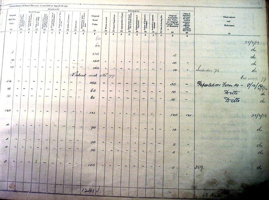
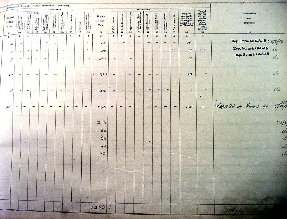
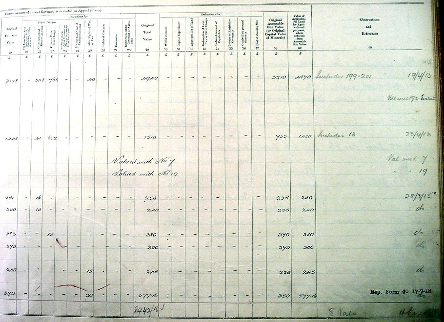
There are three Field Books containing numbers 1 to 100, 101 to 200 and 201-270. The information is presented here as follows:.
- Introduction - a description of the 3 Field Books and their contents, plus examples of the original pages.
- Data table - web page - includes 12 of the 32 data items for each Sherington property
- Complete transcription - Microsoft Excel 2003 workbook - all 32 pieces of information from the Field Books
- Supplementary information - additional information was recorded for some properties (mainly the farms and churches).
- Examples of Original Pages - digital photos of several original pages illustrating the content for different types of property.
If you spot a mistake in any of the transcriptions, please tell us, so we can correct it.
All the information on the 1910 Land Survey, the transcriptions, photos and maps are copyright. They may not be republished and they may not be used for commercial purposes.